Riverbank Collapse Iford Playing Fields: What Happened, Why It Matters, and What Comes Next
Some mornings change a place forever. In late May 2023, a local resident named Nicky Adams took her dogs for their usual walk along the River Stour at Iford Playing Fields in Christchurch, Dorset. What she found stopped her in her tracks.
A large section of the riverbank had simply vanished. Where there had been a gentle grassy slope, a well-worn path, and a line of tall trees standing at the water’s edge, there was now a steep raw drop. Soil and earth had crashed into the river. Mature trees lay sideways, their roots hanging in the air, their trunks partly submerged in the murky water below. Adams took photographs. She shared them. And within hours, the local community began to understand that something significant had happened to a place they had long taken for granted.
This is the story of that collapse — what caused it, what it damaged, who it affected, and what it tells us about the rivers, parks, and green spaces we think we know so well.
Key Facts
| Category | Detail |
| Location | Iford Playing Fields, Christchurch, Dorset, UK |
| River | River Stour |
| Collapse Date | Around May 27, 2023 |
| First Documented | May 29, 2023, by local dog walker Nicky Adams |
| Collapse Area | Several metres of riverbank, including multiple mature trees |
| Specific Location | Near the train bridge opposite Bailey Bridge Marina |
| Responsible Authority | BCP Council (Bournemouth, Christchurch and Poole) |
| Also Involved | Environment Agency (UK) |
| Immediate Response | Barriers, signage, safety cordons, engineering assessments |
| Cause | Prolonged rainfall, river undercutting, wind, vegetation loss, poor drainage |
| River Type | Both freshwater river flow and tidal influence from Christchurch Harbour |
| Soil Type | Predominantly clay — water-retaining, unstable when saturated |
| Public Uses Affected | Walking, cycling, football, rugby, paddleboarding, dog walking |
| Recovery Efforts | Native tree replanting, drone surveys, engineering review, community monitoring |
| Wider Context | Part of broader River Stour erosion and flooding concerns across Dorset |
What Iford Playing Fields Means to the Community
Before talking about what was lost, it helps to understand what was there.
Iford Playing Fields is one of those green spaces that quietly becomes part of a community’s identity. It runs alongside the River Stour in the Iford suburb of Bournemouth and Christchurch, offering open grassland, riverside paths, and that particular kind of calm that only comes from being close to moving water.
People use it for everything. Football teams train there on weekday evenings. Dog walkers come in the mornings, following the path along the river’s edge. Families spread out blankets in summer. Cyclists cut through on weekend rides. Paddleboarders and wild swimmers launch from points along the bank. Birders scan the reeds for herons and kingfishers.
It is also, genuinely, where people just go to breathe. For a lot of local residents, this space is not a destination — it is simply part of how they move through their week.
The River Stour is a big part of what makes the place so special. It adds life and movement and sound to a green space that might otherwise be ordinary. But that same river is also what makes the bank beneath those paths inherently risky. Water gives and water takes, and on the Stour, those things are closer together than most people ever stop to think about.
See also “CracksTube Explained: The Full, Honest Story Behind a Confusing Name“
The Collapse: What Actually Happened
The physical event most likely happened around May 27, 2023, though nobody saw it fall in real time. Nicky Adams discovered the damage two days later and her photographs painted a clear picture.
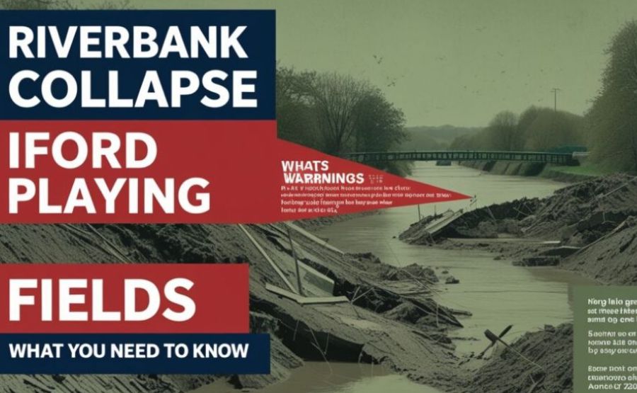
A substantial section of the embankment had completely failed. The soil, grass, and the roots that had anchored the bank for years came loose and dropped into the river. The smooth, gradual slope that had allowed walkers to stroll right to the edge was replaced overnight by a steep, raw, unstable cliff of exposed earth. Mature trees that had taken decades to grow now lay on their sides, half in the water, their root systems wrenched upward and left dangling in open air.
It did not look like a slow erosion. It looked like something had let go all at once.
That impression is accurate. What Nicky Adams photographed was not the result of a single day of rain. It was the result of years of accumulated pressure finally reaching a breaking point. The bank had been quietly failing for a long time. Nobody noticed because the signs were invisible from the surface — and then, in the space of a night, everything that had been building underground arrived all at once at the riverside path.
The Science Behind the Failure
If you have ever wondered how a grassy riverbank can simply collapse, the answer lies in a branch of earth science called fluvial geomorphology — the study of how rivers shape the land over time.
Rivers do not just flow past their banks. They push against them, cut underneath them, and slowly remove the foundation that holds the upper soil together. The process is called undercutting or toe erosion, and it works like this: the water flowing along the base of a bank gradually washes away the lowest layer of soil. The upper portion then has less and less support beneath it. Over months and years, it becomes top-heavy. Eventually, all it needs is one trigger — one sustained period of heavy rain, one strong windstorm — and the whole thing gives way at once.
At Iford, the River Stour at this particular stretch experiences something that most rivers do not. It receives both upland freshwater flow from inland and tidal influence from its downstream connection to Christchurch Harbour. That combination of two pressure sources means the banks here face more force than those on a purely non-tidal river. They have always been more vulnerable than they look.
The soil type does not help matters either. The area around Iford Playing Fields has predominantly clay-rich soil. Clay behaves in a specific and unhelpful way when it comes to river banks: it holds water rather than letting it drain through. During dry periods, it shrinks and cracks. During wet periods, it swells. Over months and years, this constant expansion and contraction weakens the internal structure of the bank. By the time heavy rain arrives, the clay is already compromised.
Add to this the position of the bank. Water flows faster along the outside of a river bend. Faster water carries more erosive energy. The section of bank that collapsed sits on or near the outer curve of the Stour’s path at this point — exactly where undercutting happens most aggressively.
Why This Particular Collapse Happened When It Did
The collapse did not come out of nowhere, but it did come suddenly — and that distinction matters.
In the weeks before late May 2023, Dorset experienced repeated periods of heavy and prolonged rainfall. The soil never had a chance to dry out between events. When soil is continuously wet, it reaches a state called full saturation. At that point, it loses the internal friction that holds particles together. The bank became extraordinarily heavy — waterlogged soil weighs far more than dry soil — and that extra weight was pressing down on an already-weakened base.
Then the winds came. Strong spring winds add a different kind of force. Trees act like sails: when wind pushes hard against a tall, leaf-heavy tree, the force travels directly down through the trunk into the root system. If roots are embedded in saturated, soft soil, they cannot hold the ground as firmly as they should. The wind wobbles the roots. The roots loosen the soil around them. The soil loses more cohesion. The cycle feeds itself.
Vegetation loss along parts of the bank added another layer of weakness. In places where grass and native plants had been cleared or thinned — partly to maintain access routes and sporting areas — the roots that normally thread through the soil and stitch it together were no longer there. Bare soil has far less resistance to erosion than vegetated soil. Research has confirmed repeatedly that plant roots provide direct mechanical reinforcement to riverbank soil, and when those roots are gone, the bank’s ability to hold itself together drops significantly.
The local drainage infrastructure in the Iford area is also aging. When drainage systems cannot cope with heavy rain, water accumulates beneath the surface near the riverbank. This hidden saturation is not visible from above — the path might look normal — but underground, the soil is completely compromised. That kind of invisible weakness is especially dangerous because nothing on the surface warns you until it is too late.
And then there is the additional pressure of regular human use. Foot traffic along the riverside path compacts the soil over time. Compacted soil sheds water less effectively than loose, vegetated soil, which means more water eventually finds its way toward the bank’s base. It is not dramatic or obvious, but thousands of footsteps a week, year after year, slowly change how a bank responds to rain.
What the Collapse Left Behind
Physically, the site was transformed.
Where the bank failed, a steep drop replaced the gentle slope. Raw earth was exposed — the kind of dark, wet, unstable material that shifts and crumbles under any weight. The popular riverside footpath was broken. Parts of it simply were not there anymore, hanging over the void where the bank had been.
The trees that fell created problems beyond the bank itself. Some lay across the water, their trunks bridging the river. Others had submerged entirely, with branches and root systems lurking beneath the surface. For paddleboarders, swimmers, and kayakers who regularly use this stretch of the Stour — particularly in summer — those hidden obstacles were a serious danger. You cannot see a submerged root ball from above. But striking one at water-surface speed is enough to cause a serious injury.
The river itself was affected. When large volumes of soil and debris enter a river all at once, they increase what scientists call turbidity — the cloudiness of the water caused by suspended particles. Elevated turbidity blocks sunlight from reaching the riverbed. That matters because aquatic plants need light to grow, and those plants form the base of the food web that supports the fish and insects and birds further up the chain. The sudden dump of sediment also altered the flow patterns at this section of the Stour, creating localized points of increased erosion elsewhere along the bank.
The riparian habitat — the ecosystem that exists at the meeting point of land and water — was meaningfully disrupted. The birds that nested in the riverside trees lost branches and cover. The small mammals and insects that depend on the layered root and soil environment of the bank lost their home. Even the shade patterns along the water changed, affecting where fish find cool, sheltered resting spots on warm days.

How the Community and Council Responded
Nicky Adams’ photographs spread quickly. Local social media groups and news outlets picked them up. Within days, BCP Council — the Bournemouth, Christchurch and Poole combined authority — had a formal response underway.
Barriers and safety signage went up around the highest-risk sections. The council closed the most dangerous parts of the riverside footpath near the A35 Iford Bridge approach while assessments were conducted. They brought in structural engineers and hydrologists to survey the collapse site, evaluate the remaining bank, and identify which sections remained at further risk.
BCP also communicated publicly — using their official channels and social media to update residents on the situation. That kind of transparency matters when a well-loved public space suddenly becomes inaccessible. People need to know what is happening and why, and they need to trust that someone responsible is actually doing something about it.
The Environment Agency was also involved, given their responsibility for flood risk management and waterway health across England. Their monitoring expertise — combined with drone surveys and ground photography carried out in the weeks following the collapse — helped build a detailed picture of the bank’s condition and the risk of further failure.
Community volunteers stepped in alongside official bodies. Local groups began their own regular observation walks, documenting and reporting any new cracks, leaning trees, or soil movement they spotted. This kind of grassroots monitoring fills in the gaps between professional inspections and has real practical value in a situation where conditions can change between scheduled visits.
Common Misconceptions About Riverbank Collapses
One thing worth clearing up is the idea that a collapse like this comes as a genuine surprise to the bank itself. It does not.
Rivers erode their banks continuously. This is completely normal and has been happening since the Stour first carved its path through Dorset thousands of years ago. What feels sudden to us — an overnight collapse that transforms a familiar view — is actually the end point of a process that may have been building for years or even decades. The bank was not healthy one morning and broken the next. It was gradually failing, invisibly, for a long time.
Another misconception is that a collapse only happens because of one cause. The Iford collapse involved at least six distinct contributing factors working together: rainfall, undercutting, clay soil behaviour, wind, vegetation loss, and drainage failure. Remove any one of those factors and the collapse might not have happened when it did. That combination of pressures is what makes these events hard to predict with precision, even when the underlying vulnerability is well understood.
Some people also assume that riverbank collapses only happen to neglected or poorly managed sites. That is not always true. Even well-maintained banks in well-monitored areas can fail when conditions align badly enough. The question is not just whether a bank is managed — it is whether the management investment matches the actual risk level of that particular location.
What Recovery Looks Like — and Why It Takes Time
Recovery from a riverbank collapse is slow by nature. The river continues flowing. The soil continues shifting. A bank that has failed once remains vulnerable until it has been deliberately stabilized.
At Iford, replanting of native trees and shrubs began in sections where vegetation was lost. This is one of the most effective long-term strategies available. Tree and shrub roots — particularly species like willow and alder that are naturally adapted to wet, riverside conditions — weave through the soil and bind it together with a strength no engineered material can fully replicate. Planted correctly and given time to establish, they rebuild the bank’s resistance from inside the soil rather than just protecting the surface.
Environmental consultants and riverbank protection specialists have reviewed what additional engineering interventions may be needed. Options under consideration include rock armour or rip-rap — large stones placed at the base of the bank to absorb and deflect the river’s erosive energy — and gabion walls, which are wire cages filled with rocks that act as flexible, heavy barriers. Bioengineering methods, which combine planted vegetation with materials like erosion control fabric or biodegradable matting, are also being considered. These approaches let nature and engineering work together rather than treating them as alternatives.
Drone surveys have continued to monitor the site, tracking how the bank is responding and identifying any sections that need further attention before they deteriorate to collapse point.
Funding is a genuine constraint here. These interventions cost money, and the BCP Council, like most local authorities in Britain, operates under significant budget pressure. Grants from environmental agencies and potential partnerships with community organisations may help close that gap, but timelines are rarely as fast as anyone would like.
The Bigger Picture: Climate, Rivers, and Public Spaces
The Iford collapse does not sit alone. Dorset has seen a broader pattern of river flooding and erosion events in recent years, including the Christmas floods that swept through Christchurch and nearby communities. The River Stour has experienced multiple bank failures at other locations too.
Across the UK, rainfall is becoming more intense and less predictable as climate patterns shift. Storms that would have been unusual twenty years ago are now arriving more regularly and with more force. Riverbeds and banks that were designed or managed for old rainfall patterns are increasingly struggling to cope with new ones.
This is not a reason for despair. But it is a reason for seriousness. Green spaces like Iford Playing Fields sit at the intersection of three things that communities genuinely need: places for physical activity, healthy river ecosystems, and safe infrastructure. When one of those fails, the others suffer. The argument for proactive riverbank management — regular inspections, early intervention when warning signs appear, proper investment in vegetation and drainage — is not simply environmental. It is practical. The cost of preventing a collapse is almost always lower than the cost of recovering from one.
There is also a responsibility question worth sitting with. Public parks and playing fields are managed on behalf of everyone in a community, including children who cannot advocate for themselves, elderly residents who depend on accessible walking routes, and wildlife that has no voice at all in planning meetings. When decisions are made about maintenance budgets, risk management priorities, and inspection schedules, those invisible stakeholders deserve to be considered.
Thoughtful Reflections
It is easy to walk past the same place every day and assume it will always be there. Riverbanks, green paths, the trees that line them — these things feel permanent in the same way that old buildings or familiar streets do. We stop seeing them as things that can change, because they have always been the same.
Iford Playing Fields asks us to think differently about the spaces we share. The river is not a backdrop to the park. It is an active force with its own patterns, pressures, and limits. When we use a riverbank for walking, cycling and sport, we are asking it to absorb both the force of water and the force of human activity simultaneously. For a long time, most banks do that quietly and invisibly. Until one morning they cannot.
The people who knew Iford well — who walked it weekly for years — were shocked when the bank fell. That shock is understandable. But it is also a signal. The things we value most in public space need attention before they reach crisis point. Not just barriers and signs after the fact. Real, ongoing care.
Rivers like the Stour are not problems to be solved. They are living systems to be respected and worked with. The best outcomes at Iford will come not from trying to freeze the river in place, but from finding ways to help it and the community coexist with the kind of knowledge and patience that prevents a surprise from becoming a tragedy.
FAQs
1. Where exactly is Iford Playing Fields?
It is located in the Iford suburb of the Bournemouth and Christchurch area in Dorset, South West England. The fields run alongside the River Stour and sit near the A35 Iford Bridge, the train bridge, and Bailey Bridge Marina.
2. When did the riverbank collapse at Iford Playing Fields?
The collapse is believed to have occurred around May 27, 2023, following a period of strong winds and prolonged unsettled weather across Dorset. It was first properly documented on May 29, 2023, by local resident Nicky Adams while walking her dogs.
3. How much of the bank collapsed?
A substantial section several metres in length gave way completely. Multiple mature trees toppled with it, their roots exposed, their trunks falling into or across the River Stour.
4. What caused the collapse?
Several factors worked together: prolonged heavy rainfall saturating the soil, years of the river undercutting the bank’s base, strong winds destabilising tree root systems, loss of stabilising vegetation in parts of the bank, aging local drainage infrastructure, and the repeated compaction of soil by foot traffic along the riverside path.
5. Why is this section of the River Stour particularly at risk?
The Stour at Iford receives both upland river flow and tidal influence from Christchurch Harbour downstream. This double pressure makes its banks more vulnerable than those on purely non-tidal river stretches. The clay-rich soil, positioned on a natural floodplain, and location near the outer curve of the river also increase the risk.
6. Is Iford Playing Fields safe to visit now?
Many areas of the playing fields remain fully accessible. BCP Council cordoned off the highest-risk sections near the collapsed bank with barriers and signage. Visitors should observe those barriers and not approach the edges of the bank in restricted zones.
7. Are there underwater hazards in the river near the collapse?
Yes. Trees and root systems submerged by the collapse create hidden hazards beneath the water surface. Anyone paddleboarding, swimming, or kayaking in the area near the collapse site should exercise real caution and avoid the immediate vicinity.
8. Who is responsible for managing the site?
BCP Council (Bournemouth, Christchurch and Poole) manages Iford Playing Fields and the public spaces around it. The Environment Agency has responsibility for flood risk management and waterway health along the River Stour. Both have been involved in the response.
9. What is the BCP Council doing to fix the bank?
The council has installed barriers, commissioned structural and hydrological assessments, and is working with environmental consultants on stabilisation options. These include planting native trees and shrubs to rebuild root-binding in the soil, and potentially installing rock armour, gabion walls, or bioengineering structures in the most severely affected sections.
10. How long will recovery take?
Riverbank recovery is a slow process. Newly planted vegetation takes years to establish the kind of deep root network that meaningfully stabilises a bank. Engineering interventions need design, planning permission, and funding before they can begin. Honest timelines are measured in years, not months.
11. Could the collapse have been predicted or prevented?
In hindsight, yes — some of the contributing factors (aging drainage, vegetation loss, clay soil on a tidal river) were known vulnerabilities. Whether they were being actively monitored is less clear. Regular inspections that look specifically for undercutting, cracking, leaning trees, and soil moisture levels can catch warning signs before they become collapses.
12. Could another section of the bank collapse?
That is a real possibility, particularly during further periods of heavy rainfall. The entire length of the bank was under the same general pressures as the section that failed. This is why ongoing monitoring — including drone surveys — is continuing across the site.
13. How does climate change connect to this kind of event?
Rainfall across the UK is becoming more intense and less predictable. Storms that arrive with greater force, more frequently, put more pressure on riverbanks that were managed for older, milder weather patterns. As conditions continue to shift, incidents like the Iford collapse are likely to become more common unless proactive management catches up with the changing risk.
14. What can local residents do to help?
Residents can follow the safety advice from BCP Council, stay behind barriers in restricted areas, report any new warning signs they notice (cracks in the ground, leaning trees, fresh soil slippage) to the council promptly, and support community groups involved in vegetation planting and monitoring. Being observant eyes along a regular walking route has real practical value.
15. Does this kind of collapse happen elsewhere in the UK?
Yes. Riverbank failures occur across many rivers in the UK, particularly in areas with heavy rainfall, clay soils, and aging infrastructure. The River Stour has experienced multiple bank failures at different locations. What makes the Iford case distinctive is the combination of its scale, the prominence of the affected recreational space, and the attention it drew to the wider questions of how public green spaces near rivers are managed and protected.
Empowering curious minds to explore, learn, and think deeper with Fact Aura.